MapViewer Sample Screen Shots

A European Road and Street Map Shown in MapViewer

A Web Based Application Using MapViewer to Show a Building Floor Plan

A Web Based Application Using MapViewer for Viewing Network Data

Demonstration Showing Field Office Information

Ship Tracking Demonstration On a Globular Projection

SVG Demonstration With Maps Produced In SVG Where You Can Actually Edit/Change Territory Boundaries

Business Analysis Demonstration

San Francisco Map Using GeoRaster

Map Showing Counties With Transparent Patterns
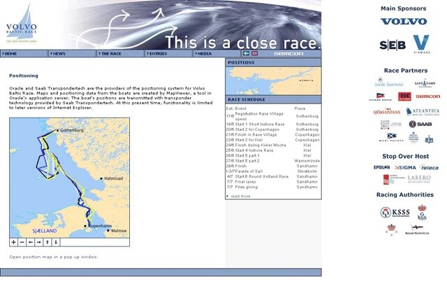
Web applicationMaps and Positioning Data From the Boats Are Created by MapViewer

MapViewer's Ability to Import External OGC WMS Layers